2024 Day Trips | Page 11 | GTAMotorcycle.com

2024 Day Trips

Is there a go to app for routes and GPX files?
Both @shanekingsley and I use The largest verified route archive thanks to MyRoute-app RouteXperts to create routes and convert them to GPX files.

I have the free version and it works well for my needs.
If you pay for it there are additional features. One of the main differences, IMO is that the map interface is the Google maps version and not their own. Their own map interface comes with the Free.

You can also pay for the navigation portion which will also allow you to use the navigation map as a GPS.

I have been meaning to pay for the lifetime subscription but I'm having a hard time justifying it. Maybe because its a subscription and not a physical item like a jacket or accessory.

All your routes are saved there and you can modify them on the fly, share them with others, make them public etc.

SK wrote about it enough times in other threads.

Give it a try, free version does not expire. Be warned, you may not like the map interface that they use. We are all used to the Google interface.

I often have the Google map on once screen and this site on the other.
The only thing I'll add is that the lifetime membership I have is a one-time purchase that includes all the upgrades that happen moving forward. I think I paid $99 for it and for the type of riding and route planning I do, it was worth it from the first multiday trip I planned out. But it might not be for everyone. They also added streetview to it as well, so toggling between regular Google Maps to aerial to streetview is really seamless.

Here's some info on it if it helps: Route Planning for GPS - MyRouteApp
 
@shanekingsley
If you have any route suggestions other than the planned route, send them over.

I will send you the GPX file anyways.
I took out Harburn Rd cuz I think it might still be gravel and added in Kushog Lake Rd since that was recently repaved and is in very nice shape. I think everything else is the same.
 
The only thing I'll add is that the lifetime membership I have is a one-time purchase that includes all the upgrades that happen moving forward. I think I paid $99 for it and for the type of riding and route planning I do, it was worth it from the first multiday trip I planned out. But it might not be for everyone. They also added streetview to it as well, so toggling between regular Google Maps to aerial to streetview is really seamless.

Here's some info on it if it helps: Route Planning for GPS - MyRouteApp
I was going to ask how much you paid.

Looks like they have a life time for $150. Not bad actually.

I was looking at $219 which included the Navigation app. Not sure how good it is or if its needed if I have a Garmin XT.
 
I was going to ask how much you paid.

Looks like they have a life time for $150. Not bad actually.

I was looking at $219 which included the Navigation app. Not sure how good it is or if its needed if I have a Garmin XT.
If you plan on doing longer rides with lot's of waypoints then I think it's a fair price. Especially for multiday trips.
I have all my past trips saved as well, so for something like my upcoming Deals Gap trip, I don't have to create them all from scratch, I can just clone my old routes and then tweak them by removing the stuff I don't want to do and adding in the new ones.

Another cool thing for my BC Trip was that I plotted the entire route as one route and then chopped it up into individual days.

I alsouse the Garmin XT as well and it's paired to my phone. That gives me the traffic updates and not sure why else I would need the Navigation app, since I hate creating routes on a phone and much prefer the laptop. I also never use my phone as a gps device, so I think for how I use a Navigation program, the lifetime gold membershiop is exactly what I want.

I also don't like planning on my phone and one of the main reasons why I like this MyRouteApp is because it has a nice web interface.
In the worse case I know I can also access it on my phone and edit a route if needed. Redownload to phone and onto Garmin.

Also, it's what I sort of learned when you introduced me to it, and as much as there may be others that are "better", I really don't want to start to learn a new product.

How are you "chopping" your route? Can you select an area but cropping it and making that a separate route?

I recently discovered the "Place waypoint button" and turned it off. I find it easier to just click a spot on the map and it becomes a waypoint. (located at the bottom of the toolkit drop down)


On that note, I will there was a way to draw or drag a general route and have the software create it for you. Based on your drawn track and edit it yourself.
They can also improve the way to rearrange the order of waypoints.

Other than that, the platform is great and I like it. Might just bite the bullet and pay the $150 for lifetime...... or maybe wait for some Black Friday/Boxing day deal.
To chop a route there’s a function enabled by the gold membership that allows you to split a route and you can choose where you want the split point to be. Then you have 2 routes with the split point as the end of the first day and the start of the second day.

I can also draw or drag the route and it will modify the route, very similar to the way that Google Maps does, except I can have hundreds of waypoints while Google Maps only allows around 10.

They do have deals for the gold membership that comes up a few times a year - that’s when I bought mine. I was happy with the free version for years, but the paid version had the extra features I wanted, so it was a no brainer for me.
 
Well , after this weekend's ride I dont anticipate any more big rides this year so I can wait for a sale.
But I will definitely purchase the gold.
 
I’ve been simply trying to run off my phone but it suck’s and I struggle with setting routes.

Eventually I’ll have to bite the bullet and pony up.
 
Why? you ride little and there are any number of phone navigation apps that do not require any cell service.
With Google Maps allowing large offline regions to be downloaded and Freebies like MAPS.ME: Offline maps GPS Nav – Apps on Google Play
there is no reason to need to spend.
Get out there....it is only Sept and lots of time to take a cruise south of the border....your bike will love you. :love:
 
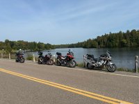
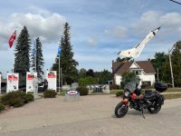
What a ride….950km in just about 12hrs. Had a blast riding with @shanekingsley @oioioi and @relict

Great roads.
Good company.
And a sore ***.

1727049129633.jpeg

1727049142410.jpeg

1727049166225.jpeg
I had to part ways with the group around 2 as I wanted to be home for 6.

1. Thanks to the Harley / CANAM train that made space for me to enter among them when I needed to pass a 20+ bike train

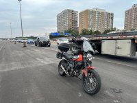
2. Bike overheated in traffic! Was going so slow on the 401 I lost my clutch again…good thing I remembered the issue before and there 2 closed lanes on the 401WB so I just jumped into the construction zone and waited 5min for the bike to cool off.

1727049039660.jpeg
 
That looks like solid run! What time did you guys start? Hit any bad fog on the way?

I did a ride up to Southwood, Bala and 518 area this morning and hit some really bad fog near Barrie. People really need to learn to turn on their lights :cautious:

Is the overheating and losing the clutch a Ducati thing or all air cooled?
We left 401/Mavis at approx 6:40am due to a rider not showing up.

Hit some fog on the 115/35 half way up to Peterborough, and after that clear skies until evening.

As for the overheating…I’m sure some are worse than others, but this is my second time. First time was waiting for a CN Rail train to pass and when it did I figured up the bike and lost all hydraulic controls.
 
Continuation of post #211…of weird things…

Smelled tons of burning rubber and thought maybe my bike caught fire or something…no no…

Amazon delivery van (Fleet optics) or whatever HAD A FIRE UNDERNEATH! The RR wheel caught fire on the inside and was burning as the oblivious driver kept going.

Tried to get his attention but he was too busy on his phone, but no vehicle fires posted on the news.
 
2. Bike overheated in traffic! Was going so slow on the 401 I lost my clutch again…good thing I remembered the issue before and there 2 closed lanes on the 401WB so I just jumped into the construction zone and waited 5min for the bike to cool off.

Is the free play properly adjusted on the clutch lever?

As the clutch plates, basket and hub expand, they tend to get further away from each other. If you have the proper free play, the slack at the lever end should compensate for this expansion and you may solve your excessive clutch slip problem when hot.
Clutch is good when normal riding...when I stopped and the bike kept heating up (I guess revving it a bit didn't help) it got to the level where I could pull the lever in to the bar with zero effort.

Pumped it a few times after 5min being off, and once re-fired up it got good (7min total stop time).
 
Are you guys running comms on your group ride? Looking to upgrade from my 2014 Sena 20s and was curious what most people are using these days.
 
Are you guys running comms on your group ride? Looking to upgrade from my 2014 Sena 20s and was curious what most people are using these days.
Depending on the group.

I group I ride with, we all have a Cardo and set up communication.

Other times with other riders we don't
 
Are you guys running comms on your group ride? Looking to upgrade from my 2014 Sena 20s and was curious what most people are using these days.
I use a Cardo Packtalk Bold and almost never connect with other riders. I just use it for music and the very rare phone call.

But I should use it more for group rides I'm leading, because it would really help when missing a spot and wanting to do a u-turn, or warning riders behind of some hazard etc.

The sound quality on the Cardo and upgraded speakers is what makes it the best choice for me.
 

Back
Top Bottom