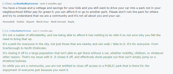
Here's the exchange I had when I went against the car ban in High Park.
View attachment 62553
The lawyers will love this if it goes to court. People that don't believe in perpetual motion should follow a well funded civil law case.
A thumbnail sketch of High Park history:
The Making of High Park
In
1836, City Surveyor
John Howard and his wife
Jemima purchased a 66 ha wooded lot on the lakeshore west of Toronto. Within a year he erected Colborne Lodge. The Howards named the estate High Park, since it is the highest point in the area.
In
1873, the Howards deeded the property to the city for use as a
"Public Park for the free use benefit and enjoyment of the citizens of the City of Toronto forever." With the exception of Colborne Lodge and a small farming operation, this land was in a relatively natural state.
In
1876 the City acquired an additional 69 ha east of the estate. It was not until
1930 that the final 29 ha including Grenadier Pond (14 ha) was added, bringing the total size to 164 ha. However, 4.5 ha of marshland at the south end of Grenadier Pond was later given to Metro Transportation when the Queensway extension was built in the early 1950’s, leaving
159.5 ha in total.
For the
first few decades after it was established, little development occurred in High Park, in keeping with John Howard's wishes that it be left in an undeveloped, natural state. It quickly became a popular destination for Torontonians wanting to picnic, walk, snowshoe or toboggan in a natural setting.
In the
early 1900s the surrounding neighbourhood became developed and public demand for active recreation increased. Trees were cleared for playing fields, new access roads were built, and non-native trees and turf grass were introduced.
In the
1950s and 1960s, a shift in policy led to the introduction of major facilities such as Hillside Gardens, the swimming pool, the zoo, playgrounds, tennis courts, concrete edging on the ponds, and groomed turf areas that included picnic sites. These developments provided many amenities to the City’s residents, but resulted in the loss of many of the Park’s natural areas.
Starting in the
mid-1970s, growing awareness of the significance of High Park's natural environment led to a number of research studies. As a result, a large portion of the park became designated provincially as an
Area of Natural and Scientific Interest, and by the City of Toronto as an
Environmentally Significant Area. Restoration is ongoing to preserve this natural asset for the long term.
Today, with its accessible location, natural features and diverse facilities, High Park continues to attract a multitude of visitors. As the population of Toronto grows and outdoor recreational activities such as running, cycling, dog walking, photography and nature study become more popular, the
responsible stewardship of this valuable resource will continue to be a challenge in the years ahead.
Now the snags
The Howards only donated 41% of High Park to the city, the rest being acquired. Does any of the Howard mandate cover the acquired lands?
A Howard request:
For the
first few decades after it was established, little development occurred in High Park, in keeping with John Howard's wishes that it be left in an undeveloped, natural state. Again 41% or ????
Does this mean any roads on the original 41% should be ripped up?
What is Toronto and who are the citizens for which the park was meant to be as a place to walk? The modern safety bike wasn't invented until 1885 so bicycling wasn't in the mind of John Howard.
The British inventor
John Kemp Starley designed the first successful 'safety' bicycle in 1885. It has all the basic features of standard modern bicycles, including chain drive, which meant that both wheels could be the same size.
What was Toronto at the time of Howard's gift?
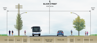
Maps of the era indicate that the northern border Toronto was Bloor Street. If the Howard mandate (for the people of Toronto) was established to be at the time of his gift, people living on the north side of Bloor Street could look across at the park but not be allowed to enter.
How about Parkdale, former Village of Parkdale? Map below. Sorry wrong side of Roncesvales

en.wikipedia.org
Popcorn anyone?


