You are using an out of date browser. It may not display this or other websites correctly.
You should upgrade or use an alternative browser.
You should upgrade or use an alternative browser.
Map folding
- Thread starter nobbie48
- Start date
When travelling I prep for the trip with Snazzy Maps - Free Styles for Google Maps, which are customizable re-stylings of the Google Maps interface. The high-contrast monochrome styles are good to start with, and you can add or remove details (road names, bodies of water, etc) and change styling (road width, etc) as you see fit.
I zoom the map so that the important details for that section of the trip will be visible when printed on paper and trimmed to fit into a ziplock bag. I usually have one map zoomed out for the overall trip, and multiple tighter zoomed maps for each segment/day of the trip. One or two maps per ziplock. The stack of ziplocks fit into the window of my tankbag, so I can just grab the next map/ziplock and swap/flip them without them getting wet or ripped.
I highlight the main route and alternate/optional side-routes/destinations in different colours. I'll often write the estimated travel time next to each highlighted route segment, so that I can easily decide on the side of the road if I want to take an optional side-route or just head straight to the day's final destination.
There's usually some blank space available to write notes like hotel details or emergency phone numbers in the margins. The custom maps also make an interesting memento/reminder of the trip when you're done.
In the days before GPS, I opened a folded map while riding up hwy 11. The map took a real beating but we got to our destination with minimal delay. I don't normally carry paper maps anymore. A few phones and/or dedicated GPS give me enough redundancy for NA.The GPS is a phenomenal device but has a major problem with long term scope of a trip. Maps are superior for an overall view of a trip but clumsy even when parked. Is this the answer?
I'm heading over to CAA for a couple of free maps.
I was going from Ohio to South Dakota and the GPS was taking me the fastest route but the direction didn't feel right. When I checked on a paper map the overall view told me the GPS was saving me a couple of minutes by taking me 30 miles out of my way via interstates through busy cities when a few more minutes on the road took me through pleasant country byways. Both are required IMO.In the days before GPS, I opened a folded map while riding up hwy 11. The map took a real beating but we got to our destination with minimal delay. I don't normally carry paper maps anymore. A few phones and/or dedicated GPS give me enough redundancy for NA.
I have an old Ontario map laying around here somewhere, the bound ones in yellow.
Will cut out a few pages and get them laminated when I go to renew my license at Staples / Service Ontario.
Will cut out a few pages and get them laminated when I go to renew my license at Staples / Service Ontario.
I don't always use navigation on the devices. Much of the time it is moving map only and navigation by me.I was going from Ohio to South Dakota and the GPS was taking me the fastest route but the direction didn't feel right. When I checked on a paper map the overall view told me the GPS was saving me a couple of minutes by taking me 30 miles out of my way via interstates through busy cities when a few more minutes on the road took me through pleasant country byways. Both are required IMO.
Paper maps rock. Nothing like being able to see the big picture at a glance. They require no power source. You can make notes on them. They look great pinned to the wall with thumb tacks indicating where you've been.
FunFact: Open a paper map at a gas station and people will come and offer to help you, then open their phone and be of almost no use. Forget Honda's you meet the nicest people with a map.
As to folding a map? Many decades ago as an Army Cadet the instructor said "a map should never be folded, it wrecks them, that said I will now show you the best way to fold one". I only remember the ironic bit. I have no idea how best to fold one.
Ontario years back folded their maps with a staggered zig zag marked with pages. You looked at an inset and opened the map to the right page. Then they went back to scrunch fold.Paper maps rock. Nothing like being able to see the big picture at a glance. They require no power source. You can make notes on them. They look great pinned to the wall with thumb tacks indicating where you've been.
FunFact: Open a paper map at a gas station and people will come and offer to help you, then open their phone and be of almost no use. Forget Honda's you meet the nicest people with a map.
As to folding a map? Many decades ago as an Army Cadet the instructor said "a map should never be folded, it wrecks them, that said I will now show you the best way to fold one". I only remember the ironic bit. I have no idea how best to fold one.
guzzirider
Well-known member
Back in the old days we only had paper road maps.
They basicly sucked! Hard to read while riding! Did not show enough detail in towns or cities!
if you made a wrong turn they left you stranded! did not tell you where gas and rest-stops where.
Paper road maps usually just show major roads. The other little black lines on the map have no reference as to pavement or gravel.
In my opinion paper maps are only good for starting camp fires.
For that you crunch them up and not fold.
Do not confuse the Global Positioning Satellite system with a commercial GPS device.
I create my own routes including gas, restraunts and other pionts of interest on my desktop using a program
that allows an unlimited number of points placed on digital maps.
OpenStreetMap is best but I can use Apple Maps (Tom Tom) or Google Maps.
My playback device is an iPad running running MapsMe.
It uses free downloadable maps and runs off the GPS chip so no data requirements.
If you insist on using a paper map you are better off buying a road atlas and cutting out the revelent pages.
That gives you far more detail.
Stack the pages in decending order and glue one edge.
That way you con tear them off and toss over your shoulder when done with them.
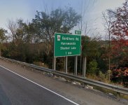
The other more simple option is to only travel on major Hi-ways and simply read the big green signs.

Almost fogot this little gem for navigation

They basicly sucked! Hard to read while riding! Did not show enough detail in towns or cities!
if you made a wrong turn they left you stranded! did not tell you where gas and rest-stops where.
Paper road maps usually just show major roads. The other little black lines on the map have no reference as to pavement or gravel.
In my opinion paper maps are only good for starting camp fires.
For that you crunch them up and not fold.
Do not confuse the Global Positioning Satellite system with a commercial GPS device.
I create my own routes including gas, restraunts and other pionts of interest on my desktop using a program
that allows an unlimited number of points placed on digital maps.
OpenStreetMap is best but I can use Apple Maps (Tom Tom) or Google Maps.
My playback device is an iPad running running MapsMe.
It uses free downloadable maps and runs off the GPS chip so no data requirements.
If you insist on using a paper map you are better off buying a road atlas and cutting out the revelent pages.
That gives you far more detail.
Stack the pages in decending order and glue one edge.
That way you con tear them off and toss over your shoulder when done with them.
The other more simple option is to only travel on major Hi-ways and simply read the big green signs.

Almost fogot this little gem for navigation

Last edited:
I find it easier to plan the route on a paper map and mark options and points of interest liberally.
I always take a paper map with me just incase I feel the need to change plans. Last summer I used Gaia GPS and with the Ontario Backroads overlay and had a great ride, taking advantage of my marked options and points of interest as the weather was great and my wife set me free for as long as I wanted.
I've always used a tank bag anyways so the map pouch is handy and visible.
I am surprised how paranoid folks are of getting lost or off track. Myself I like nothing better than getting lost. The idea of coming to an intersection and taking which way you think looks more interesting is very liberating. Doing it over and over until you have no idea where you are is a great way to see new sites and find new roads. No GPS, no phone, no worries.
I entirely agree and love to ride like that. Sadly, much less time available for wandering these days so I need to improve my odds of finding nice roads. A quick k look at a map gives me an idea of which leg looks most promising.I am surprised how paranoid folks are of getting lost or off track. Myself I like nothing better than getting lost. The idea of coming to an intersection and taking which way you think looks more interesting is very liberating. Doing it over and over until you have no idea where you are is a great way to see new sites and find new roads. No GPS, no phone, no worries.
I unfortunately don't enjoy just meandering back and forth and exploring every new area. I don't have the time.I am surprised how paranoid folks are of getting lost or off track. Myself I like nothing better than getting lost. The idea of coming to an intersection and taking which way you think looks more interesting is very liberating. Doing it over and over until you have no idea where you are is a great way to see new sites and find new roads. No GPS, no phone, no worries.
My rides consist of a fairly well laid out plan (as well as can be), with checkpoints, and to keep going.
With family obligations and what not...it's very difficult to find the time to do properly planned rides, let alone meander.
Malks
Well-known member
For our last trip to Florida in April 2022 I picked up a TripTik from CAA, as well as paper maps that include the Northeast and Southeast States. We're about to do this drive again and I got another TripTik that shows the I-75 corridor, just in case the weather makes it necessary to change our intended routing from the I-79 route we used last time. Our car has a built-in GPS unit as well so between the two I have all the information I need for the trip.
I made triptiks for our recent Florida trip. I looked at them but didn't bother printing them. They have become far less useful than in the past imo.For our last trip to Florida in April 2022 I picked up a TripTik from CAA, as well as paper maps that include the Northeast and Southeast States. We're about to do this drive again and I got another TripTik that shows the I-75 corridor, just in case the weather makes it necessary to change our intended routing from the I-79 route we used last time. Our car has a built-in GPS unit as well so between the two I have all the information I need for the trip.
If you do i-75 and have some time, "along i-75" is a good book that gives you lots of info and ideas for short detours to see interesting things.
until you hear banjos and see trailer parks.....I am surprised how paranoid folks are of getting lost or off track. Myself I like nothing better than getting lost. The idea of coming to an intersection and taking which way you think looks more interesting is very liberating. Doing it over and over until you have no idea where you are is a great way to see new sites and find new roads. No GPS, no phone, no worries.
A GPS can mess with you as well. From Google maps I knew where Jampy00 lived but my car GPS was showing me the long way around. I'll have to check if I have it set to keep me off gravel roads.
guzzirider
Well-known member
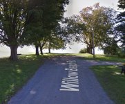
The route to the inlaws cottage via GPS took you down someones driveway to their private boat launch and told you to proceed a few hundred meters to the destination (directly across the lake). Quite entertaining. Assuming the lake was frozen, that route was ~10 minutes faster than driving around the lake to the access road.I do not consider myself lost unless I do not know what state or province I am in.
Only been lost once!
You can not get lost in Canada
Eventually you will come to water on 3 1/4 sides or hit a border crossing
Do Not Drive Beyond This Point Regarless of What Your GPS Says
View attachment 66283


