You are using an out of date browser. It may not display this or other websites correctly.
You should upgrade or use an alternative browser.
You should upgrade or use an alternative browser.
Ontario GTA photo tag
- Thread starter WudzRydr
- Start date
from what I can see on Google,Is the western GTA boundary Guelph Line and the north (west) boundary hwy 50?
North(west) boundary is Hwy7-Sideroad32-Erin/HaltonHillsTownline-CountyRoad42
West edge at that corner is Nassagaweya Puslinch Townline.
iav8
Well-known member
The West end, including the NW Corner of the GTA is defined by the Halton Regional Municipality. While I don't know all the road names off hand (Nassagaweya Puslinch Townline?) I imagine that IXFe has it spot on.Is the western GTA boundary Guelph Line and the north (west) boundary hwy 50?
vdubblues
Well-known member
New: In the hope of keeping this moving during the rainy season...

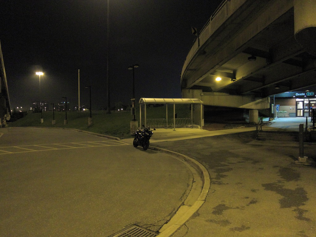
That was not taken today, LOL.
iav8
Well-known member
Correrct!That was not taken today, LOL.
... and IF you did go out in the rain and scoop that tag from me this evening I would have been very VERY disappointed! Thanks for staying dry tonight.
>> click here for Rules, GTA boundaries and Definition of "Current Photos" etc.  <<
<<
Week-in-review (Aug 3 to Aug 9)
GWS to afelotreyu!
8 of the top 9 GTA PhotoTag players were active this week!
IXFe continues to stay atop the Leaderboard with one tag this week.
iav8 grabs three tags this week to close in on afelotreyu and move ahead of bikermahn for 3rd spot.
Ride_Safe gets three tags this week to move up a spot, taking #8 away from vdubblues who got a tag just under-the-wire this week.
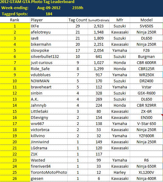
*the map has been updated
Week-in-review (Aug 3 to Aug 9)
GWS to afelotreyu!
8 of the top 9 GTA PhotoTag players were active this week!
IXFe continues to stay atop the Leaderboard with one tag this week.
iav8 grabs three tags this week to close in on afelotreyu and move ahead of bikermahn for 3rd spot.
Ride_Safe gets three tags this week to move up a spot, taking #8 away from vdubblues who got a tag just under-the-wire this week.

*the map has been updated


