Garmin Zumo on sale | Page 2 | GTAMotorcycle.com

Garmin Zumo on sale

There's a thread on ADVRider where a few people have reported their XT had fallen out of the mount. Most likely due to user error, as you do have to check whether the GPS is seated properly and that the release button has popped back up into place, and not half-way depressed.


Anyway, in the thread, there were some links to tethers that you can glue to the back of the Zumo.
I’m reluctantly considering a donation to the Teutonic Highway robberymen as they seem to be the only game in town for this GPS. At least the Canadian vendor has Sezzle so I can pretend it’s not that expensive for a few weeks. Just need to find the dimensions to make sure it will fit where I need it to go.

The good news is that I managed to remove my old Zūmo and Montana and both harnesses from my KTM quite easily and only swore twice.
 
I got the 396 and my big complaint about it is the difficulty in inputting complex routes. I never go straight from a to b, I go from a to b via c,d,e...z and inputting that type of route takes forever on the tiny little screen. Or maybe I just haven't figured out the best way to do this. There is software you can run on your computer and build a route then copy it over to the gps, but I don't want to bring my laptop when I'm touring.
 
I got the 396 and my big complaint about it is the difficulty in inputting complex routes. I never go straight from a to b, I go from a to b via c,d,e...z and inputting that type of route takes forever on the tiny little screen. Or maybe I just haven't figured out the best way to do this. There is software you can run on your computer and build a route then copy it over to the gps, but I don't want to bring my laptop when I'm touring.

I never found it that easy to do from the screen either. I did routes on a PC then transferred them afterwards.
 
ZumoXT. Edit route... Drag and drop. Done.
 
Garmin makes the TFT for the Africa Twin, Been reading some folks are having problems with the operations of them
 
Last edited:
I got the 396 and my big complaint about it is the difficulty in inputting complex routes. I never go straight from a to b, I go from a to b via c,d,e...z and inputting that type of route takes forever on the tiny little screen. Or maybe I just haven't figured out the best way to do this. There is software you can run on your computer and build a route then copy it over to the gps, but I don't want to bring my laptop when I'm touring.

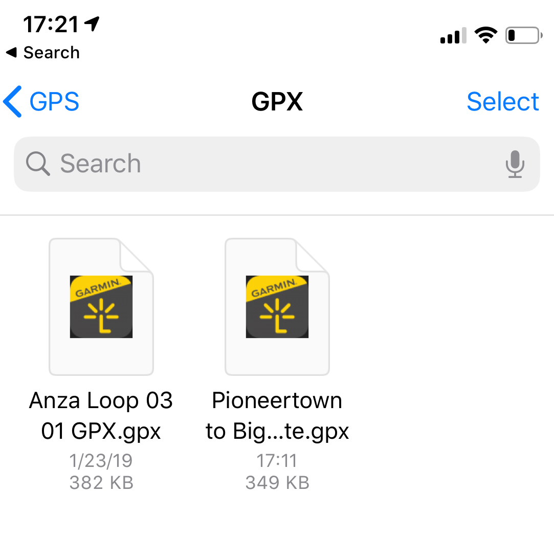
PC is best, but there is a way to use an app on your smartphone to create a route, export it to a GPX file, and then send it to your Zumo.

You'll need to load a couple of apps on your smartphone:

CaliMoto: calimoto
Garmin Smartlink App: Garmin Smartphone Link App

Step 1: Use CaliMoto to create a route. Export to a GPX file. Here are instructions:

Step 2: Use Smartlink to upload to your GPS. Here are instructions:

Step 3: Profit!
 
How stable is the XT cradle?
If you're asking how secure the XT is in the cradle, mine came with one of those rubber thingies that goes around the back of the cradle, with four corners you pull around the unit itself. With that in place, there should be no way the unit would fall off.
 
I have a Tom Tom Rider (550 I think) that came with my BMW F700GS... Never really used it... Never really understood the appeal of it versus Waze where I get police and speed trap warnings.

@Lightcycle - do I switch the Tom Tom to the bike I'm shipping there or just stick with Waze?
 
Have the Zumo 590 and love it. Never had a problem with it and loading routes is super simple. Took me to BC and back on one trip and then down to Deals Gap on another with zero issues. Lockable cradle and hardwired to bike. Traffic updates, fast rerouting, seamless connectivity with phone and helmet comms and it’s also survived a couple impressive bike drops.
 
I have a Tom Tom Rider (550 I think) that came with my BMW F700GS... Never really used it... Never really understood the appeal of it versus Waze where I get police and speed trap warnings.

@Lightcycle - do I switch the Tom Tom to the bike I'm shipping there or just stick with Waze?

If you're happy with Waze, then stick with it.

Most people don't need a HW GPS.

But if you're finding you're getting frustrated at:

- having to pull over and take your gloves off often to operate your phone - even those touch-friendly gloves don't work well, because it's like trying to operate your phone with oven mitts on
- you need the flexibility to add or edit your route often because you're in explore-mode vs A-to-B mode
- the online maps don't have enough detail or are not accurate in not-as-well-trafficked areas or dirt trails
- you worry that the only lifeline to civilization, and all your important contacts and data are just sitting right there on the handlebars and one good dump on the trails will render it useless

then maybe you're a candidate for a dedicated HW GPS. If not, then continue using your phone. I know you're going to Europe, but if you're sticking to paved roads in Western Europe and not exploring the dirt trails in Albania or Georgia, then Google Maps and Waze will serve you well in those areas.

DSCN9414-L.jpg

Albanian man on a horse says hi to us...

My buddy used to make fun of me all the time because I always used a HW GPS. He said Google Maps always did what he needed and it was free for both the HW and SW. I took him out to the Washington Backcountry Discovery Route last summer. This winter, he went out and bought a Zumo XT.

I didn't rub it in... too much...
 
Last edited:
Good reminder. I should get a Note4 that's lying around and convert it to a dedicated GPS.

I'm using a unit kindly donated by a great GTAMer and it works great, but is a bit dated and the maps may be out of date. Due to issues with charging the unit I end up using the power bricks to keep it going throughout the longer riders.
 
hen maybe you're a candidate for a dedicated HW GPS. If not, then continue using your phone. I know you're going to Europe, but if you're sticking to paved roads in Western Europe and not exploring the dirt trails in Albania or Georgia, then Google Maps and Waze will serve you well in those areas.
You can use Garmin maps on a phone, but you can't use Google Maps on a Garmin ¯\_(ツ)_/¯
 
You can use Garmin maps on a phone, but you can't use Google Maps on a Garmin ¯\_(ツ)_/¯

The maps I use are not from Garmin. They're made by 3rd party organizations who aren't happy with either Garmin or Google maps because they're incomplete for specific regions. Google and Garmin don't pour money into exploration + development for these places because so few people travel there. They're made specifically for HW GPSes.

We were in a remote region in Guatemala, far away from the main road, no reason for anyone who didn't live there to be out in that area. Official Garmin map showed nothing. I had loaded two different 3rd party mapsets on our GPSes. One of them showed the road ended at this river, the other one, an obscure map I found, showed this makeshift ferry:

DSCN1830-L.jpg


No one but locals using it. If I hadn't had found the second map, we would not have been able to travel through this region. I haven't bought an official Garmin mapset since the first time I bought a GPS, over 20 years ago. And that was because I didn't know any better at the time.

I'm not trying to convince anyone to use HW GPS. If you're happy with your phone then keep on using it. I think I've stated that multiple times before.
 
Last edited:
The point is you can use any map on the smartphone, including the map you just described, but your choice what you can use on the Garmin device is limited.

I'm not trying to convince anyone one way or another either, but I, personally, stand somewhere in the middle - I think standalone device based on Android, that can run any app, is the best choice. Unfortunately, no one makes android based navigation devices for motorcycles, so I opted to get a cheaper Android based phone instead. It doesn't tick all the boxes for me, that a specialized navigator device possibly can, but will see how it goes.
 
There are workarounds to get HWGPS tilesets onto a phone, but they are kludgey and never as integrated and streamlined as using a HWGPS. Have you tried these apps? I have. The tilesets were never meant for a non-HWGPS interface. It's like overlaying a jpg over the Google Maps app. Routing is not 100% foolproof and the accuracy is not as good as a HWGPS.

If you are hellbent on using your phone, then you can make it work and swear and grit through the process. But at the end of the day, the experience will never be as good as just using it on the device that the map tilesets were originally compiled for.

Personally, the whole capacitive vs pressure-sensitive touch screen is a deal-breaker for me. I don't want to stop to pull off my gloves all the time. I've done the phone GPS thing many times enough to know it's just not for me.

Here's me, using an android phone for navigating through Gran Canaria.

DSCN3073-XL.jpg


In town, the buildings were too tall so the GPS chip on the phone wasn't good enough to get an accurate lock on the satellite. And because the streets were too narrow and close to each other, Google Maps was skipping around like it had epilepsy. So I had to stop to pull off the gloves to scroll around to figure out where we were and to fix the routing. Something that I wouldn't have had to do with a HWGPS.
 
Last edited:

Back
Top Bottom